Azure Computer Vision API 有一組很好的 Demo 來展示對圖片相關的視覺分析,當然還有 客製化的 Computer Vision,可以訓練自己的電腦視覺模型或是領域特定的模型,並且開放成 API 進行服務串接。整個流程就是非常地快速能夠上線,當然如果還想優化,就必須從演算法層級下手了。

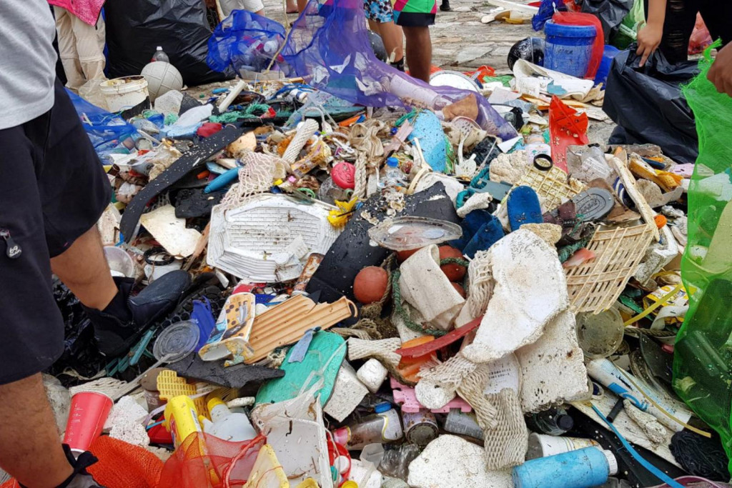
以下是進行一個實驗,我們把海岸廢棄物的一張照片進行基本的圖片分析與描述,結果如下:(可以看到它已經有往廢棄物分類的方向辨識,再搭配機械手臂撥動、連續拍攝辨識,效果真是令人期待)
說明
{
 "tags":[
    "person", "food", "picnic", "people", "sitting", "messy", "table",  "group", "cluttered", "items", "grass", "child", "bag", "many", "pile", "woman", "young", "standing", "stuffed", "crowded", "bed", "fruit", "bear", "birthday", "produce", "eating", "bowl", "sandwich", "man", "room", "playing"
 ],
 "captions":[
    {
       "text":"a group of people sitting at a picnic table",
       "confidence":0.7931016
    }
 ]
}
類別	[ { "name": "people_crowd", "score": 0.46484375 } ]
臉部	[]
主要色彩背景	"Black"
主要色彩前景	"White"
輔色	#AD2C1E
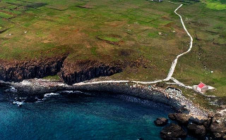
接下來我們把澎湖南方四島國家公園的照片,進行地景辨識。

這個地方人煙罕至,岸邊卻聚集著許多不知從何而來的海漂垃圾。當我們在進行大規模自動化監控的時候,我們會需要進行地景與分析結果的配對。實驗結果如下:(地景是一系列的線索,根據信心程度排列順序)
{
  "categories": [
    {
      "name": "outdoor_",
      "score": 0.01171875,
    },
    {
      "name": "outdoor_oceanbeach",
      "score": 0.37890625,
    },
    {
      "name": "outdoor_stonerock",
      "score": 0.296875,
    }
  ],
  "tags": [
    {
      "name": "grass",
      "confidence": 0.99790191650390625
    },
    {
      "name": "water",
      "confidence": 0.974234938621521
    },
    {
      "name": "outdoor",
      "confidence": 0.95973360538482666
    },
    {
      "name": "nature",
      "confidence": 0.82509434223175049
    }
  ],
  "description": {
    "tags": [
      "grass", "water", "outdoor", "nature", "rock", "river", "standing", "sitting", "small", "bird", "large", "blue", "man", "body", "pool", "walking", "flying", "umbrella", "kite", "people", "board", "white", "ocean", "swimming", "group"
    ],
    "captions": [
      {
        "text": "a body of water",
        "confidence": 0.82268123921942859
      }
    ]
  },
  "color": {
    "dominantColorForeground": "Black",
    "dominantColorBackground": "Brown",
    "dominantColors": [
      "Black"
    ],
    "accentColor": "13445D",
    "isBWImg": false
  }
}
